Mt Rose Road Bike Ride Out & Back Ride Details
Challenge:
Steep continuous climb with high speed return descent. Make sure your brakes are in good working order.
Trailhead:
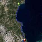
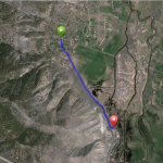
Start at the intersection of Hwy 28 and Country Club Dr. turning right on Country Club Dr. (opposite of Sierra Nevada College), then right on Ski Way, left on First Green Dr, and right on Fairview Blvd. to Mt. Rose Hwy (431).
GPS: 39.268485, -119.936074 (Hwy 28/Country Club Dr.)
GPS: 39.313070, -119.897338 (Summit)
GPS: 39.329536, -119.887038 (Mt. Rose Ski Area)
The Bike Ride:
Mt Rose Road Bike Ride: This is a classic Tahoe road bike ride with “unworldly” spectacular views on the crest of the Carson Range. It starts in Incline Village by traveling on low traffic volume neighborhood streets connecting to Mt. Rose Hwy 431 – nicked named the “Highway to the Sky”. The Hwy is wide with good shoulder widths. However, alertness is recommended as motorists tend to travel at high speeds. Once you connect to the Hwy, turn right you will ride a .5 mile to one of the best scenic overlooks in all of Tahoe. From here you overlook Diamond Peak Ski Area and can see the entire Tahoe basin. Continue your climb and you will ride through Tahoe Meadows – popular for hiking in the summer and XC skiing in the winter. At the Summit is a turnout with rest rooms. Here you have the option of returning or continuing to the Mt. Rose Ski Area to check it out for your possible winter plans. This ride goes to the ski area. The ski area is actually situated on Slide Mountain (9,698’) and Mount Rose is the highest mountain (9,710’) to the north west of you. Caution is recommended on the return descent as your speed can get high. Once you pass the Scenic Overlook remember to begin slowing down as Fairview is only .5 mile on your left – you will see a road sign indicating entering Incline Village and Fairview is on the left.
This is also a popular route for road cyclists living in the Reno area. From the east side, the Hwy narrows on the climbs and is steep with many winding turns.
Preview Ride:
Historical:
In the late 1800’s, this area was depleted of its forest to provide timber for the silver mining operations in Virginia City 20 miles away. In the early 1950’s Hwy 431 was improved to provide a connection from Reno to the Lake Tahoe ski areas in preparation for the 1960 Winter Olympic Games in Squaw Valley (Olympic Valley, California).
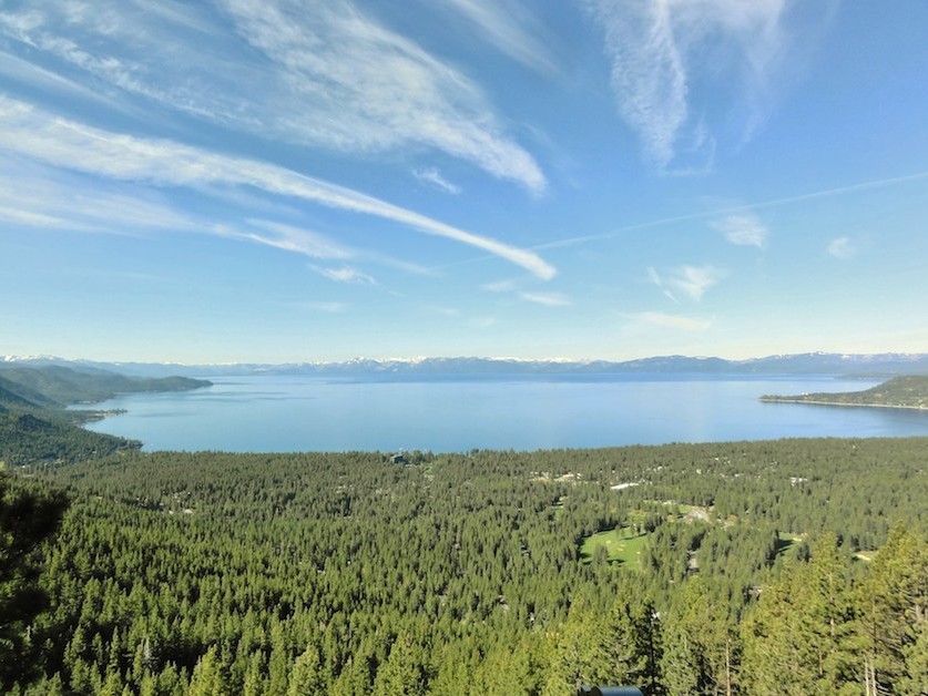 Captivating view from this vista overlook